Southeast Asia Collection / Map Collection
The examples shown here are a selection of maps of Indonesia held in the Maps Special Collection. Click on the thumbnail images to see a larger version of the maps. All maps are available for viewing during Special Collections business hours.
Aa, Pieter Vander, 1659-1733. De Moluccos, of Speceri-dragende eilanden tussen Gilolo en Celebes gelegen. Leide : Aa, [1714?]. Call Number: G 8130 1714 .A12.
Note that map is orientated with north pointing to the right side of the map.
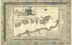
Aa, Pieter Vander, 1659-1733. La Rade de Bantam, Dressee sur les Observations des Meilleurs Geographes. Leide : Aa, [1729]. Call Number: G 8074 .B33 1729 .A12
From Aa's La Galerie Agréable du Monde, 1729.
Bellin, Jacques Nicolas, 1703-1772. Batavia Assiece en 1629 / Batavia A°.: 1629 Belegerd. [Paris? : Bellin?, 175-?]. Call Number:G 8074 .D3 1629 .B45
Notes : Engraved by J. V. Schley.
The pictoral map is of Batavia in 1629, but published by Bellin over a century later.
Bellin, Jacques Nicolas, 1703-1772. Carte de l'Isle Celebres ou Macassar, pour Servir a l'Histoire Generale des Voyages. [Paris? : Bellin?, 175-?] Call Number: G 8110 1750z .B45
Bellin, Jacques Nicolas, 1703-1772. Carte Particuliere de l'Isle d'Amboine/Byzondere Kaart van het Eyland Amboina. [Paris? : Bellin, 175-?]. Call Number:G 8132 .A6 1750z .B45
Bellin, Jacques Nicolas, 1703-1772. Carte des Environs de Batavia, Tiree des Hollandois. [Paris : Bellin, 176-?]. Call Number:G 8074 .D3 1760z .B45.
From Bellin's Le Petit Atlas Maritime, 1764.
North is to the left side of the map.
Bellin, Jacques Nicolas, 1703-1772. Carte Particuliere des Isle Moluques. [Paris : Bellin, 1764]. Call Number:G 8130 1764 .B45
From Bellin's Le Petit Atlas Maritime, 1764.
Bellin, Jacques Nicolas, 1703-1772. Isle de Baly / 'T Eiland Baly. [Paris? : Bellin?, 175-?]. Call Number: G 8072 .B3 1750z .B45.
Notes : Inset shows "Plan d'un Palais du Roi."
Engraved by J.V. Schley.
Bellin, Jacques Nicolas, 1703-1772. Isle de Machian / 'T eyland Makjan ;Isle de Bachian / 'T eyland Batsjan. [Paris : Bellin, 1750?]. Call Number: G 8132. M3 1750 .B45.
The lower bird's eye view is oriented with north to the lower left.
Bellin, Jacques Nicolas, 1703-1772. Isles de Banda = Eylanden van Banda. [Paris? : Bellin?, 1750?]. Call Number: G 8132 .B4 1750 .B45
Bellin, Jacques Nicolas, 1703-1772. Plan de l'isle Onrust / Grondtékening van 't eiland Onrust. [Paris : Bellin, 1750?]. Call Number: G 8092 .O5 1750 .B45.
Note: A small island in the bay of Jakarta.
Bellin, Jacques Nicolas, 1703-1772. Ternate. [Paris? : Bellin?, 175-?]. Call Number: G 8132. T4 1750 z .B45
Includes Dutch and French index to numbered sites.
This is a bird's eye view of the city from the sea.
Bonne, Rigobert, 1727-1794. : Carte des isles de la Sonde et des isles Moluques. [Neuchâtel : Chez le Librairies Associés, 1783]. Call Number: G 8070 1783 .B65
From G.T.F. Raynal's Atlas de Toutes les Parties du Globe Terrestre, 1783-1784.
Dower, John, fl. 1838-1846?. East India Islands. London : Orr, [185-?] Call Number: G 8070 1850 .D68
Le Rouge, Georges-Louis. Isles de la Sonde. Paris : Chez Crepy, [1767?]. Call Number: G 8070 1767 .L42
From Le Rouge's (?)Atlas Nouveau Portatif à l'usage des Militaires, Collèges et du Voyageur, 1767-1773.
Le Rouge, George-Louis. Isles Moluques. [Paris : Le Rouge, 1756?] Call number: G 8130 1756 .L47
From Le Rouge's Atlas Nouveau Portatif à l'usage des Militaires, Collèges et du Voyageur, 1756-1759.
Philippe de Prétot, Etienne André, d. 1787. Plan de la Rade de Batavia. [Paris : Nyon l'ainé, 1787]. Call Number: G 8092 .C6 P5 1787 .P45