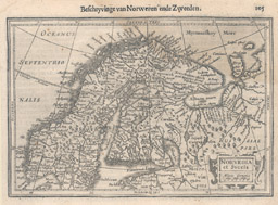
The examples shown here are a selection of maps of Europe held in the Maps Special Collection. Click on the thumbnail images to see a larger version of the maps. All maps are available for viewing during Special Collections business hours.
Mercator, Gerhard, 1512-1594. Norvegia et Svecia. [Amsterdam : Ian. Ianssen, 1630]. Notes : At the top of the map: "Beschryvinge van Norwegen ende Zweeden." Call number: G 6910 1630 .M42
From Mercator'sAtlas Minor, 1630.
Text in Swedish on the verso.
Ptolemy, 2nd cent. Tavola Nuova de Germania. [Venetia : V. Valgrisi,1561]. From Ptolemy'sGeographia, edited by Girolamo Ruscelli, 1561. Call number: G 6081 .S2 1561 .P788
Text in Italian on the verso.
Seale, Richard William, 1732-1785. Hellas, sive Graecia Propria.[S.l. : s.n., 176-?]. Call number: G 6810 1760z .S43