Southeast Asia Collection / Map Collection
The example shown here is held in the Maps Special Collection. Click on the thumbnail images to see a larger version of the map. All maps are available for viewing during Special Collections business hours.
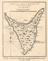
Map of Anjouan [Nzwani], one of the Comoro Islands[Bellin, Jacques Nicolas, 1703-1772]. Carte de L'Isle D'Anjouan / Kaart van 'T Eiland Anjuan. par le Cap. Cornwal. [Paris?: Bellin?, 1748?] Call number: G 9212 .A5 P5 1748 .B45
Information on the Comoro Islands from Kansas State University: General information ; Geography
Details on Anjouan, otherwise known as Nzwani.