Southeast Asia Collection / Map Collection
The examples shown here are a selection of maps of China held in the Maps Special Collection. Click on the thumbnail images to see a larger version of the maps. All maps are available for viewing during Special Collections business hours.
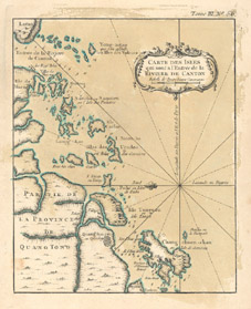
Bellin, Jacques Nicolas, 1703-1772. Carte des isles qui sont a l’entrée de la rivière de Canton. [Paris : Bellin, 1764]
[Tome III, No. 56.] Call number: G 7822 .C4 1764 .B45
From Bellin’s Le Petit Atlas Maritime, 1764.
Ptolemy, 2nd cent. [ASIA] [4 Maps]: India Orientalis, Chinae Regnum, Iapania Regnum, Insulae Phillipinae. [Douay? : Wytfliet?, 1605?] Call number: G 7401 .S2 1605 .P78
From: Wytfliet's Histoire universelle des Indes..., 1605?
Chinae regnum (one of 4 maps on a single sheet)
Sanson, Nicolas, 1600-1667. Tryk van China, door N. Sanson d’Abbeville. [Paris? : Sanson?, 168-?]. Call number: G 7820 1680z .S35