Southeast Asia Collection/ Map Collection
Rare Books and Special Collections holds more than one hundred maps specifically of Burma or representing a larger geographical area including Burma, from the 1500s to the 1800s, many of them hand-colored. A small selection of these maps have been digitized and are accessible from this page. Some of the images have been adjusted to fit a Web browser. File sizes of larger images are indicated. You can also click on the thumbnails for full-size views of each item.
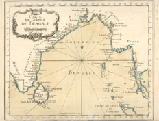
Bellin, Jacques Nicolas, 1703-1772.Carte du Golphe de Bengale. [Paris : Bellin, 1764]. Call number: G 7652 .B4 1764 .B45
From Bellin's Le Petit Atlas Maritime, 1764.
Bellin, Jacques Nicolas, 1703-1772. Port et Bourg de Mergui. Paris: [Bellin],
1764
Call number: G 7724 .M4 1764 .B45
From Bellin's Le Petit Atlas Maritime, 1764.
Clüver, Philipp, 1580-1622. Indiae Orientalis et Insularum Adicentium Antique Et Nova Descriptio. [Wolfenbüttel? : Per I Bunonem?, 1667?]. Call number: G 8000 1667 .C58
Large portion of the map: 171K
Detail of Burma, listing Ava, Aracan, and Pegu: 62K
Galvao, Antonio D. D'India anze Landschappen
Leyden, 1729 [Detail]. Call number: G 8000 1729 .C35 Full map: 151K
Mercator, Gerhard, 1512-1594.India Orientalis. [Amsterdam : Ianssen, 1630]. From his Atlas minor, 1630. Call number: G 7400 1630 .M47
Small view of the map: 75K; Full map: 173K; Enlarged view of the map: 288K
Note the scale used for this map: 100K
Detail of Pegu (note that it is depicted as an island): 138K; Detail of the coastal region: 108K
Moll, Herman. The East Part of India, or, India Beyond the R. Ganges. London, 1729. Call number: G 8005 1730 .M65
Larger, full-sized view: 166K; Detail of Ava: 47K
Enlarged detail of Ava and Pegu from Chaammay Lake to south of Merguy. Note that Pegu is not depicted as an island and appears further upriver from the mouth of the Pegu River: Larger version: 366K
Although the next three maps are listed as attributed to Ptolemy, he died centuries before they were created. Ptolemy did not travel to what became Burma; he compiled second-hand information gathered from travellers. He also thought that the Indian Ocean was closed and there was a "Great Promonotory," a land bridge between Africa and Asia.* None of these maps depict the Indian Ocean as closed. Vasco da Gama and his crew had already travelled from Europe to India around Africa in 1498.
*Suarez, Thomas. 1999. Early Mapping of Southeast Asia. Singapore: Periplus Editions.
This book is located in the Southeast Asia Reference area, 4th Floor, Call number:GA 1141 .S68 1999
Ptolemy, 2nd cent. [ASIA] [4 Maps]: INDIA ORIENTALIS, CHINAE REGNUM, IAPANIA REGNUM, INSULAE PHILIPPINAE
Douay?, 1605? Call number: G 7401 .S2 1605 .P78
This map features four separate maps on one sheet. Here is the map India Orientalis: 162K
Sotheby's: Natural History, Travel, Atlases and Maps, from an auction in London, 13 November 2003, Lot 222 cites these maps from Cornelis van Wytfliet's Histoire universelle des Indes occidentales, published by Francois Fabri, in Douai,in 1611. The original book included these "4 small maps on one double-page sheet in Magini's supplement showing the East Indies, Japan, China and the Philippines. The four maps illustrating the supplement are after Langenes (1598)." Wytfliet created his atlas after Ptolemy's Geography.
Unfortunately, NIU does not hold Wytfliet's complete atlas. It was a common past practice to separate maps from atlases (often from incomplete or damaged copies),and sell them piece by piece.
Ptolemy, 2nd cent. India Tercera Nuova Tavola. [Venetia : Appresso Vincenzo Valgrisi, 1561]. Call number: G 8001 .S2 1561 .P76
This map lists Berma, Martaban, and Pegu: 137K
Ptolemy, 2nd cent. Tabula orientalis regionis, Asiae scilicet extremas complectens terras & regna. [Basiliae: Apud Henricum Petrum, 1540]. Call number: G 7401 .S2 1540 .P76
This map was scanned in two sections and pieced together. Larger image: 210K
Detail:

Seutter, Matthaeus, 1678-1756.Asia, cum omnibus imperiis provinciis,statibus et insulis, correcta et adornata per Mattaeum Seutter. Augsburg : Tobias Conrad Lotter,[1744]. Call number: G 7400 1744 .S48
Full map, 250K;Note the variety of scales listed on this map, 150K
Note: India is labelled on both sides of the Golfo di Bengala and colored green, 233K
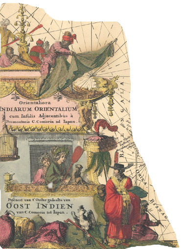
Goos, Pieter.Pascaert van t'ooster gedeelte van Oost Indien van C. Comorin tot Iapan. [S.l. : s.n., 165-?]. Call number: G 8001 .P5 1650z .C66
Detail